Open Sundays/Public Holidays 10.00 am to 3.00 pm
Easter hours: Good Friday 18/4 -- Closed
Easter Saturday 19/4 -- Open 10 am to 12.30 pm
Easter Sunday 20/4 -- Open 10 am - 3.00 pm
Easter Monday 21/4 -- Open 10.00 am - 12.30 pm
In this series:
The Story of Clare's Riesling Trail
Chapter 1: Clare gets a Railway
Chapter 2: Clare to Spalding Line
Chapter 3: Clare Railway Station saga
Chapter 4. Clare Railway declines
Chapter 5: Riesling Trail Planning & Building
Chapter 6: The Riesling Trail now
The Riesling Trail Story
Chapter 5. Planning the Riesling Trail
The Riesling Trail is one of the Clare valley's most outstanding recreational eco-tourist attractions.
The 1983 bushfires that destroyed sections of the Riverton to Spalding train line, the decision to shut the line down, and the demolition and removal of the rail infrastructure could have devastated a lesser community.
Instead it opened the way for a trail to be created that would enhance tourism of the region and make good use of the derelict and unsightly rail corridor.
"For a few years after the 1983 bushfire there were moves to restore the railway as a tourist venture.
At the time South Australia already had three tourist railways that were heavily dependent on community funds and labour.


Riesling Trail Sevenhill Church

Cycling the Riesling Trail

Riesling Trail, Join as a Friend
Riesling Trail Sevenhill Church
From Destruction to Trail
The first fire of the day was reported south of Adelaide mid-morning.
Within hours, more than 180 fires had broken out across two states.
They would eventually raze 400,000 hectares — an area four times the size of metropolitan Melbourne.
"The whole hills were alight," remembers Susan Laundy, a resident of Mylor, a small community inland from Adelaide.

-
There were two imaginative schemes that could have happened only with major public or corporate sponsorship.
-
The first was a plan to relocate the Peterborough collection to Clare and convert the track to narrow-gauge.
-
Scheme two would have kept the railway to its original gauge, and
-
embarked on the construction of a full-size working replica of South Australia's original 1856 Fairbairn locomotive with matching carriages.
-
Neither proposal could stimulate the required volunteer or financial support and in 1989 the demolition contractor moved in."
Graham Mill wrote that:
"Australian National Rail in many ways vandalised the infrastructure of the railway with the demolition of bridges and rough removal of other items of historic relevance."
"Thankfully the bridge abutments, the embankments and cuttings, along with two bridges were too costly to remove."


Leading Lights of the Trail
Fortunately the time was right, with a focus by the Office for Recreation and Sport on developing trails suitable for walking and cycling.
"Terry Lavender, for the Office of Recreation and Sport (ORS), became a leadling light in the development of the Heysen and Mawson tracks."
A dilemma for the winemakers of Clare was --
What could be done to enhance the tourism potential of the region,
by making use of the derelict and unsightly rail corridor.
Two winemakers:
-
Evan Hiscock from Petaluma,
sat down together with -
Leith Hughes from the Office of Recreation and Sport (ORS) and
-
Greg Carmody of Transport SA
-
together they developed a vision for a trail in the late 1980s that
-
would allow a range of walkers and cyclists
-
to explore the length of the valley and
-
discover the beauty of this very special wine region.
-
Councils Meet
John Wilson in his book "The Riesling Railway" reports that the local councils of Clare, Saddleworth, Auburn and Riverton met to consider whether they could
-
keep the railway lines open
-
establish a tourist railway, and
-
swing the public support to carry the project forward.
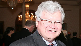
The Minister for Transport, Gavin Keneally (pictured left), member for Peterborough, advised that ANR could probably ask for $800,000 compensation if they were unable to to salvage the materials along the Riverton-Clare line.
-
In December 1989 the District Council of Riverton drew attention to the possibility of the rail corridor being sold to local farmers.
-
In July 1990 the four district councils, including Spalding, produced a report to Government that they wished to retain the railway corridor for recreation purposed.
-
In April 1993, the Riverton Council requested urgent action from the appropriate Minister to save the land for a recreation reserve.

Clare Winemakers
In October 1992 the Clare Valley Winemakers Association held a Creative Think Day intended to find a way to distinguish the region's Riesling wine.[11]
Tony Brady of Wendouree Cellars suggested a trail be built using the old railway formation, and that it be called the Riesling Trail.
-
He was supported by Evan Hiscock of Petaluma Wines.
-
The proposal gained support from Terry Lavender of the State's Office of Recreation and Sport.
Its name "The Riesling Trail" derives from
-
the landscape of vineyards through which it passes and
-
the affinity to the region of the Riesling grape that produces internationally acclaimed wines of that variety.

The following is from "The Riesling Trail" (A History),
by Tony Brady, Evan Hiscock, John Wilson, Allan Mayfield, Graham Mill, Trevor Schmidt, Russel Schmidt and Gary Sims
(unpublished 22-page manuscript, no date, but possibly 2016).
Tony Brady has said:
There was a latent "community aspiration to turn the disused railway into a trail".
-
The railway corridor remained disused, with some landholders wishing to absorb the railway corridor into their own properties
-
In order to sell off the land parcels to the surrounding landholders for a small amount, it would have been a very expensive exercise to survey each individual parcel,
-
which may have been the saviour of the absorption of the corridor
Progressing the Riesling Trail was initially fuelled by the desire to stop an urban development near Warenda Road, Clare, which would potentially tarnish the aesthetic and tourist appeal of the area.
-
The urban development of Warenda Road was supported by the Local Government
-
Tony Brady objected that the urban development of small parcels of land would weaken the visual appeal and charm of the region.
-
Tony Brady enlisted the help of architect Michael Towa, Professor of Architecture at the University of Sydney to create an artist's impression of the altered view of the vineyard area converted into housing.
-
Tony's appeal to Clare Council was dismissed, but he persevered.
Duncan Miller's story "The Vision Splendid" on Tony Brady, Adelaide Review October 1992
Miller wrote that the obstacles to the Riesling Trail plan were money and bureaucracy.
-
"Money will never be easily found, though the Winemakers' Association... will provide a strongly reasoned lobby for support (and funding) from
-
businesses and agencies closely involved with Wine Tourism and the Clare Valley."
-
Also,
"Brady's analytical approach should leave the most quick-witted bureaucratic feeling foolishly obfuscatory. -
Also the strongly solvent District Council of Clare will help give the project some impetus to roll it through the corridors of power."
The development of The Riesling Trail happened as a result of a passionate campaign by local winemaker Tony Brady, backed up by a local volunteer support organisation.
-
Tony Brady, based in Clare, completed a great deal of the work on the feasibility of the Trail.
-
Evan Hiscock, based in Adelaide, was able to initiate discussions with the department of Sport and Recreation officers, Terry Lavender and Leith Hughes.
The Winemakers advertised in the Northern Argus in November 1992,
"For some years now, the Clare Valley Vignerons have had their eyes on the long-abandoned Railroad Track which runs through the centre of the Clare Valley from Riverton to Spalding.
"Their idea is to turn it into what is termed The Riesling Trail, to be used by walkers, horse riders (and) bike riders visiting the Clare Valley".

1992

Registration of the Name
By the 21st December 1992, "The Riesling Trail" was a registered business name by the Clare Winemakers, starting December 1992 to the 21st February 1999.
This was later changed to a Goods and Services Registered Trademark from the 10th of February 2000.
The Riesling Trail represents the hard work of more than 70 people who have pulled together over the years to turn the vision of two winemakers into a reality.
Founding president Graham Mill gave a recount of the development of the cycling and walking track that extends from Auburn in the south to north of Clare at the AGM 2018.
Below: Alan Mayfield, Graham Mills and Peter Wood
The Riesling Trail follows the contours and curves of the former railway from Auburn to Clare, providing ever-changing views of vineyards, mixed farms, natural bushland and world-renowned wine region.
A quality, compacted surface and easy gradient makes it ideal for walkers and cyclists of all levels, as well as wheelchair and pram users.
There are wooded sections that feel like English laneways and embankments that give sweeping views of villages and the hills.
Along the way there are picnic spots and storyboards about the history, the landscape, the Ngadjuri people, the communities and local heroes.
At 35km, the Riesling Trail walked one-way in about 9 hours (or ridden one way in about 2.5 hours).
To do the lovely countryside justice, and enjoy the hospitality of the wineries, attractions and accommodation close by, give yourself more time and make the trail a leisurely pursuit.
You can start your journey from a number of sign-posted side roads in each town (and even between towns). There are car parks close to the trail in Auburn, Watervale, Sevenhill and Clare.
Water tanks are provided at the Watervale and Sevenhill shelters.
The trail markers you encounter along the way feature distances, directions, services and stories. View some history on notes on rieslingtrail.com.au.


1993
Riesling Trail Logo
By February 1993, John Newland and Evan Hiscock had designed and agreed upon the logo for the Riesling Trail.
-
Evan Hiscock and Tony Newland also designed road crossings similar to pedestrian railway crossings, to make the trail user cross the roads with caution.
-
Vehicle access was also designed to be restricted, but still allow vehicle access in case of an emergency.
-
The current Riesling Trail logo was derived from the old Clare Valley Winemakers logo by Giedre Millard,
-
which had previously been used on signage on the Riesling Trail.
-
The ‘R’ was included to differentiate it from the Winemakers logo
-
and adopted by the Riesling Trail.
-

Aims of the Riesling Trail
An announcement was made in mid-1993:
"As a joint initiative of the Clare Winemakers' Association and the Department of Sport and Recreation, we intend to convert the Auburn to Clare section of the disused railway line into a walking/cycling/riding trail."
"The project will involve:
-
fencing,
-
planting,
-
and signage"
"We hope to be underway later in 1993".
In July 1993, a half-kilometre example of the trail, with the railway ballast removed, was constructed by Clare Quarry Pty. Ltd.
-
This trial section was only one metre wide.
-
The entire planned route of 24 kilometres was walked by Tony in six and a half hours.
The listed aims of the trail were formally developed by mid-1993:
-
Continuous walking, cycling, riding, wheelchair access
across the trail Auburn to Clare -
Wildlife corridor from Auburn to Clare
-
Access to wineries and other facilities (from the Trail)
All aims were to reflect the sub-regional variation along the 24km trail.
Highlights of 1993
-
Architectural students invited to study the Trail.
Third-year architecture students were invited to stay at Claymore Wines (7145 Horrocks Highway Leasingham South Australia) to complete a project and proposal on the Riesling Trail.
-
The students were able to select any aspect they wished to study about the trail
-
The idea was to encourage active involvement
-
However, few of the proposals would easily transfer to the Trail.
The project was still succesful in
-
building momentum
-
engaging as many people as possible,
-
and creating awareness
-
and fostering connection to the trail.

2. Visit by Greg Crafter, former Minister for Local Government, and Recreation and Sport Minister:
Clare District Council arranged for a visit by Greg Crafter.
-
When the Minister questioned were the funds were going to be found,
-
Tony Brady replied "from the Public Open Space fund".
-
The Minister was considered to be
-
"one of the State's better politicians,
-
he was experienced, held no ego,
-
and was sympathetic with the battler." - (Brady, 2016)
-
A major challenge and cost linking the Clare and southern sections of the trail was the replacement of the Quarry Road bridge, removed during the demolition of the rail line.
3. Approach to BHP Steel Works by Tony Brady
Reasoning that the Wine industry had used a lot of steel, Tony Brady approached the principal of BHP Steel works in Whyalla, George Edgar, for a donation of steel to build a bridge crossing over Quarry Road.
-
"George was a boy from Newcastle, a wine lover, and not really interested in bureaucrats" (Brady, 2016)
-
George was leaving his job in a month's time and he made sure he organised what was required for
-
Bluey Jenner of Clare Metal Fabrications to fabricate the bridge in Clare
-
This bridge was fabricated 12 months before the first openings and sand models
-
the bridge was fabricated locally, built offsite, and slotted into place with perfect precision.

Walking the Riesling Trail
Review of Riesling Trail
Reviewed July 11, 2017
While staying in a lovely B&B with a frontage of the Trail, we embarked on our daily walk, and were very surprised at the winding way and many vineyards sharing the trail.
This early in the morning, we did see a couple of visitors on push bikes, but many people were out walking, even sprinting in this carefree and safe treat!
Trail Distances
-
Auburn to Watervale 9km
-
Watervale to Sevenhill 9km
-
Sevenhill to Clare 7km
North of Clare: -
Clare to Barinia Road, White Hut 10km
Extend your walk options by continuing south from Auburn on the Rattler Trail, 19km to Riverton.

4. News Release Advertiser 23 Oct 1993
"A new walking trail in the Clare Valley is planned to take in
-
spectacular rural countryside
-
historic towns
-
a railway reserve and

"The Recreation and Sport Minister Mr Crafter said yesterday an initial $10,000 was being spent on a sample section of the Riesling Trail between Sevenhill and Penwortham.
The Riesling Trail will eventually stretch about 70km from Riverton to Hilltown along the now disused Riverton to Spalding Railway.
-
The Trail will go through the historic towns, villages and hamlets of
-
Auburn, Leasingham, Watervale,
-
Undalya, Sevenhill, Clare and Hilltown.
-
-
Mr Crafter said the trail, which would be open to walkers, wheelchair users, cyclists and horse riders, would boost the tourism and business potential of the region."
"The Trail's project manager Terry Lavender said the walk wove through the heart of the wine-growing district and passed 22 wineries.
-
Nature lovers could enjoy abundant bird life along the trail and could visit the State's nethermost stand of stringybark forest in the Spring Gully Conservation Park.
-
Mr. Lavender said the trail, when complete, would link up with the Heysen and Mawson trails.
-
The railway was opening in 1918 and closed in 1984 after bushfires damaged the lines, sleepers, and rails.
-
Mr Lavender said the first part of the Trail would be ready in three months, and the rest in three years."
Riesling Trail Sevenhill Church
Cycling the Riesling Trail
Riesling Trail, Join as a Friend
Riesling Trail Sevenhill Church
Trial Sections Opened - 1994
In May 1994, two trial sections of The Riesling Trail were officially opened
-
Sevenhill to Watervale, and
-
Riverton to Rhynie.
These sections were officially opened in May 1994 by the Minister for Recreation, Sport and Racing, John Oswald M.P.
-
This was the first conversion of a railway line into a recreation trail for walking and cycling in South Australia.
The Clare Valley Winemakers Association continued to drive development of the Trail.
-
The first section of trail construction from Sevenhill to Clare commenced in April 1997.
-
The second section was from Watervale to Sevenhill
-
The third section was from Penwortham to Watervale.
-
Lastly, the final section from Watervale to Auburn was completed by August 1998.
“Without the surface being to a good standard, the Riesling Trail is nothing, it wouldn’t have its reputation as one of the best rail trails in Australia,” Mr Hill said.
“Wind, rain and general use slowly wears down the surface; water drainage is a big thing, and we need the trail to be slightly elevated to get water to run off."
Gary Sims from Clare Quarry originally constructed the trail. Trevor Schmidt developed a technique for laying the surface of the trail, which has stood the test of time, and the Schmidt family continues to support the trail still today.
1994
1997
1998
“Without the surface being to a good standard, the Riesling Trail is nothing, it wouldn’t have its reputation as one of the best rail trails in Australia,” Mr Hill said.
“Wind, rain and general use slowly wears down the surface; water drainage is a big thing, and we need the trail to be slightly elevated to get water to run off.

With history, scenery, cellar doors and an art gallery, this former rail-trail takes its name from the grapes the Clare Valley’s famous for.
Get the most from cycling the Riesling Bike Trail.
-
Spans the 35 kilometres between Clare and Auburn, and about two hours drive from Adelaide,
-
cyclists consider the Riesling Trail to be one of the best bike trails near Adelaide,
-
dare we say one of the best bike trails in South Australia?
No bicycle? No problem.
-
Bike hire is available at a variety of locations along the trail.
-
And while balancing wine bottles on a bicycle isn’t recommended, cellar door purchases can be shipped to your accommodation in the Clare Valley or home.
You’ll need a minimum of 2.5 hours to cycle the Riesling Trail but factor in extra time to truly enjoy this stretch of countryside and cellar door hospitality along the way.
There’s also plenty of places to stop and learn about the Indigenous history of the Ngadjuri people via storyboards along the trail.
Above: Ethel and Graham Mill
Official Opening 1998
The Riesling Trail section between Clare and Auburn was officially launched on 7 November 1998.
-
In November 1998 the Riesling Trail was officially opened by then Minister for Recreation, Sport and Racing, Iain Evans.
Riesling Trail Management Committee
At a public Meeting in May 1999 the Riesling Trail Management Committee was established as a community management group.
-
Initial members were Patricia Jacka, Graham Mill, Carita Brown, Leith Highes, Ted Nettleton, Rosemary Goode, Bev Hannaford, Richard Rowe, and Julie Cowperthwaite.


Landscape Masterplan 1999
A Landscape Masterplan for the Riesling Trail was developed in August 2000 by EDAW Australia. It was prepared in co-operation with the Office for Recreation and Sport, and the Riesling Trail Management Committee, with significant community consultation.
Following detailed site analysis, five landscape character zones were identified:
-
Clare carpark to Wndouree Road
-
Wendouree Road to Penwortham Station
-
Penwortham Station to Watervale Station
-
Watervale Station to Main North Road, Auburn
-
Main North Road, Auburn to Auburn township
Special Issues
The Plan provided a vision for the Riesling Trail, and identified specific issues which needed to be addressed:
-
Planting - where the aim is to enhance the existing landscape and reinforce its varied and diverse character
-
Signage - entry/gateway signs to Trail land, information and interpretive signs, directional signs and regulatory signs
-
Public Art - the incorporation of art works is seen to a vital and creative part of the development, and the plan assist in location and possible themes to enhance the trail.
-
Facilities - key priorities were shelter, benches, and bicycle racks
-
Trail mapping - eight aerial photographs provided detailed mappaing of the Trail between Clare and Auburn, with specific locations for landscaping, facilities, public art, and signage.
-
Implementation - priority developments were identified and amenity planting recommendations were made.
Further Trail directions
New Developments included:
-
Route changes to the Mawson Trail to link it to the Riesling Trail
-
Re-development of the Leasingham winery to enable extension of the Riesling Trail to the North, and better linkage to the Clare township
-
A series of loop trails which link the Riesling Trail to attractions and provide a diversity of experiences for trail users
-
Extension of the trail to Barinia Road in the North, to extend the Trail for the whole length of the Clare Valley Wine Region:
-
major attractions North of Clare township
-
accommodation at the Clare Country Club
-
quality Bed and Breakfast units
-
a scenic link to the Mawson Trail
-
Public Art
In 2000, with funding from the SA ORS, (ORSR - Office for Recreation, Sport and Racing) a landscape master plan was developed, which included a concept for public art along the trail.
The first installation, ‘Power Lines’ by local artist Vivian Ziersch, was completed in 2008, with two further installations, ‘The Gathering’ and ‘Mob of Sheep’ completed within the last two years.
There had been strong pressure to demolish the bridge extending north across the Farrell Flat Road which would take the trail to the official northern boundary of the Clare Valley wine region, but fortunately the trail management committee won, and the trail now runs to the former Barinia rail siding at White Hut.
Issues still to be dealt with
-
how to cross the Wakefield River at Auburn
-
to bring the trail along the former rail corridor and to the Auburn Railway station,
-
and then onto the Rattler trail leading to Riverton.
In his address to the Friends of the Riesling Trail, Mr Mills acknowledged the donations of money and in-kind work and support
-
by the local community, landowners,
-
Clare Valley wine makers,
-
SA Tourism Commission as well as
-
the numerous state and federal government grants that have enabled the construction and continuous maintenance of the trail to occur.
The Friends of the Riesling Trail Inc
The Friends of the Riesling Trail Inc, committee intends to continue in this tradition,
-
maintaining the trail surface and surrounding landscape, and
-
the addition of new artwork in the Watervale region in the coming years.
The next big project anticipated by current Chairman Alan Mayfield is
-
the compiling of a detailed history of the Riesling Trail,
-
including interviews with those involved in its early years,
-
which could culminate in the publishing of a book.
The trail has boosted the local economy by
-
attracting additional visitors to the region,
-
boosting tourism and creating job and
-
business opportunities in bicycle hire and cycling tours, and
-
will remain was South Australia’s first rail trail, and arguably its best.
What better way to celebrate the 20th anniversary of the trail, than with a stroll or ride along the entire length, or at least a small section.
- A meander through 20 years of the Riesling Trail by KEIRA JAMES November 19 2014

The New Riesling Trail
The Riesling Trail is 33 km’s long.
The southern terminus is the restored Auburn railway station building which is now home to Mount Horrocks Wines.
-
The Trail is connected to the township by travelling west across the River Wakefield via a cycling/walking bridge.
-
Once on Horrock’s Highway, trail users travel north via a shared pathway and connect with the railway corridor just north of the town.
-
From here it rises through constantly changing countryside, overlooking many vineyards which provide outstanding views.
The Trail passes through the small township of Leasingham which has cellar doors and an art gallery to visit located a short distance from the Trail.
-
From Leasingham the Trail leads onto the village of Watervale which has a number of places for users to visit.
-
Exploring towards the eastern side of the trail users can visit places such as wineries, a pub and the General Store.
Soon after leaving Watervale, the Trail passes under Horrock’s Highway before reaching its summit in Penwortham, the first site of European settlement in the region.
-
Close by are the historic St Mark’s Church and John Horrocks Cottage (previously known as Green’s cottage) which are both linked to the founder of the village, John Ainsworth Horrocks.
In this series:
The Story of Clare's Riesling Trail
Chapter 1: Clare gets a Railway
Chapter 2: Clare to Spalding Line
Chapter 3: Clare Railway Station saga
Chapter 4. Clare Railway declines
Chapter 5: Riesling Trail Planning & Building
Chapter 6: The Riesling Trail now